
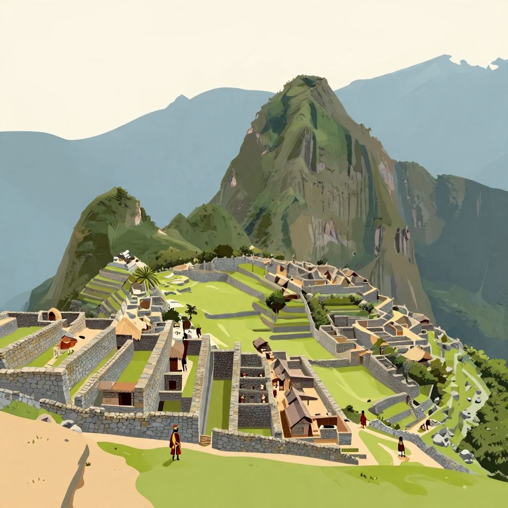
Where did the Incas live? In the broadest sense, the Inca civilization was centered in the Andes of western South America, with its political heart in and around Cuzco in present-day Peru. At its height in the 15th and early 16th centuries, the Inca Empire stretched far beyond that core, reaching across mountains, valleys, deserts, and coastlines.
The answer is both geographic and historical: the Incas began as a regional power in the central Andes and then built the largest empire in pre-Columbian America. Their homeland, imperial capital, and conquered provinces were not one single place but a vast, connected highland world shaped by altitude, roads, agriculture, and state control.
Where Did the Incas Live?
The Incas lived primarily in the Andes Mountains, especially in the region around Cuzco in modern-day Peru. From there, their empire expanded along the western side of South America into parts of present-day Peru, Ecuador, Bolivia, Chile, Argentina, and Colombia. Their core was highland Peru, but their state reached many ecological zones.
The Inca homeland in the Andes
The earliest Inca rulers emerged in the Cuzco Valley, a high-altitude basin in southeastern Peru. This was the political and ceremonial center of Inca identity. The surrounding Andes provided steep terrain, fertile valleys, and access to multiple climate zones within short distances, which helped the Incas support a large population despite difficult mountain conditions.
Because the Andes rise sharply from coast to high plateau, the Incas did not live in one uniform environment. Some communities lived in highland towns and farming terraces, others in river valleys, and still others in coastal or jungle-edge regions after expansion. The empire was diverse, but its ruling elite remained strongly tied to Cuzco.
Cuzco: the Inca capital
Cuzco was the ceremonial and administrative center of the Inca state. In Inca tradition, it was the sacred city from which the empire radiated outward. Archaeological evidence and later Spanish accounts both show that Cuzco was a major urban center with elite residences, temples, storage facilities, and ritual spaces.
Inca rulers treated Cuzco as more than a capital. It was the symbolic “navel” of the world in Inca political thought, linking the empire’s sacred geography to its ruling dynasty. From Cuzco, roads, messengers, armies, and tribute moved across the empire.
How the Inca Empire Expanded Across South America
The Incas did not always rule a huge empire. They started as a local Andean people and expanded dramatically in the 15th century, especially under rulers such as Pachacuti and his successors. By the early 1500s, the empire—often called Tawantinsuyu—covered a vast stretch of western South America, though local cultures and languages remained important within it.
From local rulers to imperial power
Scholars generally place the rise of the Inca state in the early 13th century, though exact origins are partly wrapped in later royal tradition. For a long time, the Incas were one among several regional groups in the Andes. Their transformation into empire occurred much later, in the decades before Spanish arrival.
The empire’s growth was driven by military conquest, diplomacy, marriage alliances, and the strategic relocation of populations. Inca rulers often incorporated local elites rather than replacing them entirely, which helped them govern a large and varied territory.
The four regions of Tawantinsuyu
The Inca Empire was divided into four major regions, or suyu, which radiated from Cuzco. This structure reflected both geography and administration:
- Chinchaysuyu — the northwest, the largest and most populous region
- Antisuyu — the eastern mountain slopes and jungle edge
- Collasuyu — the southern highlands, including areas around Lake Titicaca
- Contisuyu — the southwest, toward the Pacific coast
This division shows that the Incas lived across many environments, not just in one mountain city. Their empire included high plateaus, coastal valleys, and transitional zones leading toward the Amazon basin.
The Geography of Inca Life
To understand where the Incas lived, it helps to understand the Andes themselves. Inca society was built around altitude. People lived at different heights for different purposes: farming, herding, administration, ritual, and trade. The empire’s strength came partly from its ability to use multiple ecological zones rather than relying on a single landscape.
Highlands, valleys, and terraces
Most Inca communities lived in highland valleys and on carefully built agricultural terraces. These terraces turned steep slopes into productive farmland and helped control erosion and water flow. Crops such as potatoes, quinoa, maize, and beans were grown according to altitude and climate.
In the highest zones, people also herded llamas and alpacas, which were essential for transport, wool, and meat. Lower valleys could support maize and other crops that required warmer temperatures. This vertical use of land was a key feature of Andean life long before the Incas, but the empire organized it on a much larger scale.
Coast, mountains, and jungle edge
Although the Inca heartland was mountainous, the empire reached the Pacific coast and the eastern slopes of the Andes. Coastal regions were important for fishing, cotton, and trade. The eastern frontier, where the mountains descend toward the Amazon, was harder to control and remained more contested.
Inca rule was therefore not limited to one “Inca city” or one kind of settlement. It was a network of centers, roads, storehouses, and local communities spread across difficult terrain.
What Kind of Places Did the Incas Build?
The Incas lived in both ordinary settlements and highly organized state centers. Their architecture and urban planning were adapted to the mountains, with stone construction, narrow streets, and strong drainage systems. Some sites were residential, while others served ritual, military, or administrative purposes.
Cuzco and other major centers
Cuzco was the most important Inca city, but it was not the only one. The empire included administrative centers, provincial capitals, and ceremonial sites. These places helped the state collect tribute, store food, and project power. Many were connected by the famous Inca road system.
One of the best-known sites is Machu Picchu, built in the 15th century high in the Andes. It was not the empire’s capital, and it should not be treated as the only or even typical Inca settlement. It is better understood as a royal estate or elite site within the broader imperial landscape.
Roads, storehouses, and waystations
The Incas also lived in a world shaped by infrastructure. Their road network linked distant regions and included waystations, bridges, and storage facilities called qullqas. These storehouses held food, textiles, and equipment, allowing the state to support armies, labor projects, and relief efforts during shortages.
This system made it possible for the Incas to govern a vast empire without relying on wheeled vehicles or draft animals like horses. Human labor, llamas, and organized logistics did much of the work.
Who Lived in the Inca Empire?
It is important to distinguish between the Inca people and the broader population of the empire. The Incas were originally a specific ethnic and political group centered on Cuzco. As their empire expanded, millions of people from many different societies came under Inca rule.
A multiethnic empire
The empire included speakers of Quechua, Aymara, and many other languages. Some groups were incorporated peacefully, while others were conquered. Inca rule often preserved local leaders and customs as long as tribute and loyalty were maintained.
This means that when people ask where the Incas lived, the answer cannot be reduced to one ethnic homeland alone. The ruling Inca elite lived in Cuzco and imperial centers, but Inca power extended over a broad and diverse population across the Andes.
Mitmaqkuna and resettlement
The Incas sometimes moved populations within the empire in a policy known as mitmaqkuna or mitimaes. These relocated communities could serve military, agricultural, or political purposes. Such resettlement helped the state control newly conquered areas and spread loyal populations across strategic zones.
This policy also shows that Inca life was dynamic. People could be moved far from their original homes, so “where the Incas lived” sometimes meant where the state placed them, not just where their ancestors had lived.
Daily Life in Inca Lands
Inca daily life varied by region and status, but most people lived in agricultural communities tied to local kin groups. The empire depended on labor obligations rather than money taxes. Households contributed work to state projects, farming, road building, military service, and religious observance.
Homes and community life
Common Inca homes were usually simple, made of stone, adobe, or mud brick depending on local materials. Families lived in small compounds or villages, often near fields and water sources. Elite housing in Cuzco and other centers was more elaborate and used finely cut stone.
Community life revolved around agriculture, ritual calendars, and reciprocal labor. The state did not erase local life; instead, it layered imperial administration onto existing Andean social structures.
Religion and sacred landscape
The Incas viewed the landscape as sacred. Mountains, springs, rocks, and temples could all hold religious significance. Their worship of the sun god Inti is well known, but Inca religion was broader than that and included many local deities and sacred places. Their living spaces were therefore also spiritual spaces.
Temples and shrines were often placed in locations that reflected political power and sacred geography. This helped the state connect religion, kingship, and place.
What Happened to the Inca Homeland After the Spanish Arrival?
The Spanish conquest in the 1530s shattered Inca political control, but it did not erase Inca people or Inca places. Cuzco remained an important city under Spanish rule, though its political meaning changed dramatically. Many Andean communities continued to live in their ancestral regions, even as colonial rule transformed land ownership, labor systems, and religion.
Continuity and change
After conquest, the Inca elite was displaced, killed, or absorbed into colonial society, and the imperial center lost its sovereignty. Yet Inca-descended communities persisted throughout the Andes. Quechua-speaking populations, local traditions, and memories of Inca rule survived in altered form.
Today, the legacy of where the Incas lived is visible in archaeological sites, mountain terraces, road traces, and living Andean cultures. The empire’s geography still shapes how historians understand state power in difficult terrain.
So, Where Did the Incas Live?
The Incas lived in the Andes of South America, with their core centered on Cuzco in Peru. As their empire expanded in the 15th and early 16th centuries, they ruled lands across much of western South America, from high mountain valleys to coastal deserts and frontier zones. Their world was not a single city but a connected imperial landscape.
In short, the Incas lived where the mountains, valleys, and roads of the Andes allowed them to build one of history’s great empires. If you want to explore related historical geography, you may also enjoy reading about what Guatemala is known for and where Prussia was.